10 day ocean forecasts and other new SeaState features
We’ve been hard at work with our partners developing new aquaculture intelligence tools and couldn’t be more excited to share the news. SeaState, Scoot’s flagship aquaculture intelligence platform, now includes:
- 10 day ocean and weather forecasts for every farm site
- A new site to site comparison tool
- An enhanced equipment management and mitigation data capture tool set
Introducing 10 day forecasts
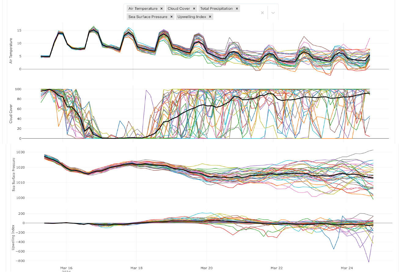
This week we launched 10 day ocean and weather forecasts to improve planning and mitigation opportunities for all farm sites in SeaState. Unlocked by your farm’s ocean observations and Scoot Science’s models, these forecasts will give your team cutting edge ocean risk awareness.
Scoot’s new 10 day forecasts are designed to consistently deliver the most complete picture of expected ocean and weather conditions at every farm site. The ocean models capture marine processes like tides, currents, and biology interacting with the weather (think wind, rain, sunlight). In SeaState farmers can view the full range of weather model scenarios from a 30+ model ensemble alongside the ocean forecast. With this model transparency, farmers can have the confidence that their operations decisions are as informed as possible at every farm.
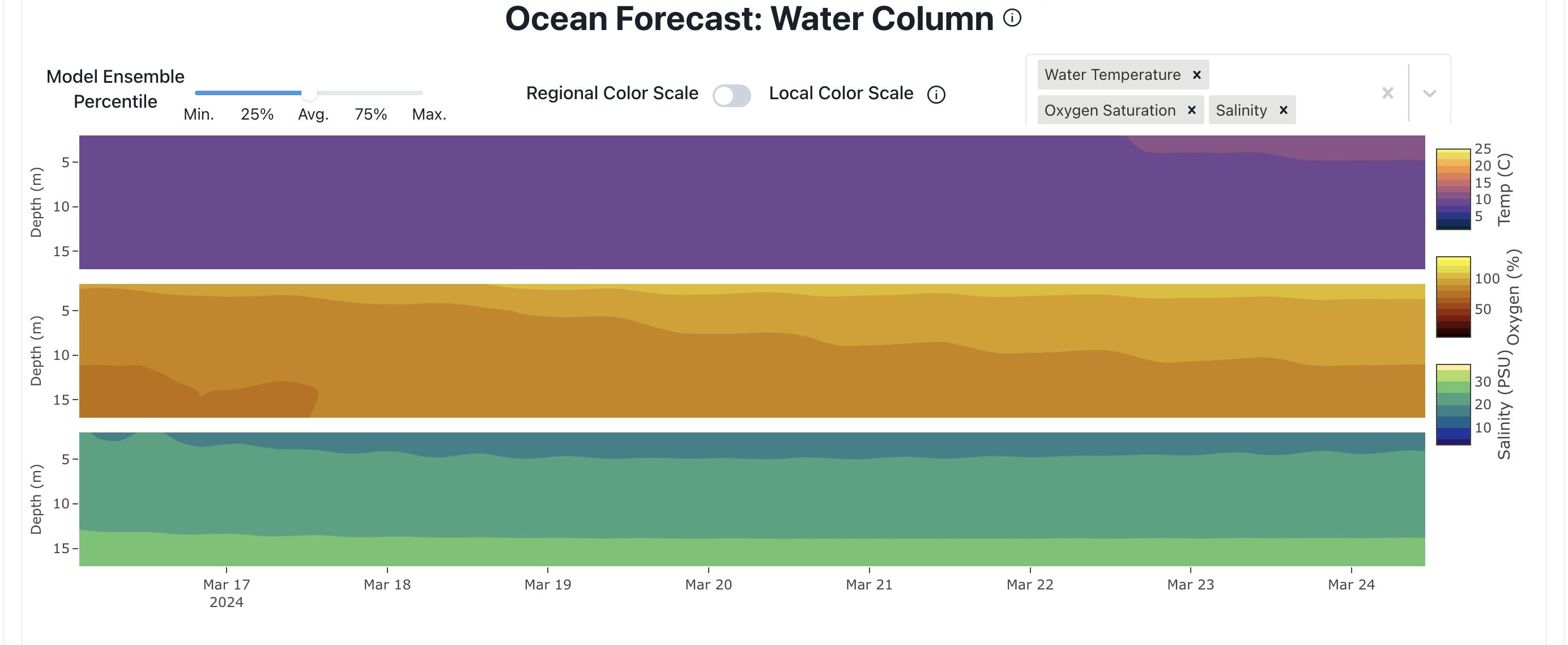
Want to learn more about our physics-based forecasts of oxygen, temperature, and salinity? Check out this previous blog post, or reach out to info@scootscience.com to schedule a live demo.
Introducing the site comparison tool
This week we’ve also launched a new tool to give farms direct comparisons between all of the sites within a SeaState project. This is the fastest and most direct way to assess the state of all the saltwater production sites in your organization.

All SeaState users now have a “compare all sites” button in the upper right hand corner of each map. This link opens up a window to the Environmental Conditions, Fish Health, Plankton, and Sea Lice across the sites. Site managers and production directors will be able to instantly see which sites are most affected by a regional ocean risk, benchmark performance between sites, and plan operations across all regions.
Teams using SeaState as a common operating picture can seamlessly assess and take action on the challenges and opportunities within and across their sites.
Enhanced equipment management and mitigation data capture
Finally, capping the developments this week, we’ve redesigned SeaState’s equipment management and mitigation data tools so that farmers can fully integrate their actions on a site with the surrounding ocean conditions. With this toolset farmers can clearly identify and evaluate the couplings between the operations and ocean conditions at every farm.
Life support tools like barriers, aeration arrays, and oxygen generators are all aimed at enhancing fish welfare and sustainability at a farm. However, until now it’s been difficult to easily capture the data describing how these mitigation tools are used and near impossible to understand in real-time how they’re affecting the fish.
With our new equipment management tools farm staff record the status of mitigation systems and actions directly in SeaState. This information is stored and shared seamlessly through the SeaState platform so that data describing oxygen flow rates and mitigation duration sit alongside ocean oxygen levels and fish mortality counts. With SeaState’s new equipment toolset your team will be able to assess the efficacy of farm life support systems and develop the optimal practices to maximize fish welfare.